


Digital Charts & Flight planning

Includes the following charts:Visual 500 Chart BeneluxVisual Approach Charts Benelux

Flight Planner Software provides electronic flight planning on interactive charts. Just cklick to define your flight route, and Flight Planner automatically identify Airfields/Airports, NavAids, Airspaces, and calculates for each leg heading, distance, flight time and more.Flight Planner features:Trip Kit Assistent with scaled chart printing.Radar-Loop from pc_met directly on the ICAO chart.Web Links on the chart.Perfect chart handling seamless rolling and zooming.Auto-Route function creates a leg suggestion.Fast planning based on a voluminous data base.Graphical approach planning with Weight & Balance calculation.Chart printing of each cutout possible.Integrated GAFOR and METAR recall from pc_met and NOTAM services of the DFS via internet(both optional).GPS coding of all established Garmin handheld receiver.Large chart range: ICAO charts, VFR approach charts from AIP VFR, Jeppesen VFR/GPS charts Europe, General charts of Germany 1:200:000 and also topographic charts 1:50.000.System requirements: Windows 98/ME/NT4.0/2000/XP, min. Pentium II 266 MHz, 512 MB RAM, display 800x600 with 256 colors, min. 15 MB free harddisk space (80 MB recommended) - plus charts (size depending on the version).This version is: Flight Planner 6 (full version) incl. ICAO Charts Germany.Delivery includes: Manual in german language
Includes the following charts:ICAO-Chart Germany HamburgICAO-Chart Germany HannoverICAO-Chart Germany FrankfurtICAO-Chart Germany StuttgartICAO-Chart Germany RostockICAO-Chart Germany BerlinICAO-Chart Germany NürnbergICAO-Chart Germany München

Perforated, 7-hole punched (edges) for Jeppesen binder.500 letter size sheets print up to 1.000 Jeppesen size sheets.

Visual approach charts from the German AIP VFR, including updates for one year, free download via Internet.

Easy planning of routesBecause of the simple and fast user interface, it is possible to consider easily "what-if": What is if the wind does not come from the northeast, but from Southwest? How long takes the detour around the control zone? How much fuel do we need for a spontanous trip to another field? All these questions can be answered quickly by calculating in real time. Perfect pre-flight preperation in a few minutes thanks to the comfortable and simple functions of the Flight Planner.Insert, update, and delete the waypoints directly on the map.Automatic locking on the nearest airfield or NavAid.The auto-route feature you created from a starting point and a destination airport creates a route proposal that you can then change manually.Planning about the database: your can also plan your route by entering the waypoints via the keyboard without taking even the mouse in your hand. The fast and extensive database supports your planning.ElevationThe height profile shows a vertical section of the planned route. Underlaid is the height profile with a digital elevation model, which gives you an immediate initial impression of terrain to be traversed. With the vertical section you recognize immediately whether your planning airspace is violated.Extensive databaseWith the Speed Search function, you have quick access to more than 5,000 known waypoints of the database (Europe version). All waypoints are typed and easy to identify by a symbol. Refine your search list to the desired waypoints.Internet links directly on the cardWeb links on the card allow the direct retrieval of information from the Internet. The link icons appears everywhere on the map where additional information is stored.Weight & BalanceWith the help of the graphical representation of the cabin layouts you can load your aircraft with a simple drag and drop in seconds. The weights are preselected with the provisions of JAR-OPS 1 and 3. When you change the loading of the contents of the tank or the effect on the center of gravity, it is visible immediately in the envelope. The fuel calculation shows the fuel demand that you will need for the planned route. Since version 5.5, for helicopters, additionally the lateral center of gravity calculation is supported.Take-off distance calculationWith the start- and landing distance calculation window you can calculate your aircraft take-off and landing distances for your start- and landing runway taking various factors into account.Convenient GPS programmingWith the Flight Planner and a data cable you have your Garmin GPS in handle. By pressing a button you can transfer your planned route into the GPS. Check the routes, waypoints and tracks from your GPS, with the Flight Planner, you can edit this data and write it back comfortably. With the GPS or PDA recorded flights, you can play back later with the Flight Planner. On the map all the details are displayed as you would operate the flight straight.Printing of briefing materialsWith the Flight Planner, you can print the required informations for the flight briefing documents quickly. There are several flight log formulars at choice, the flexible MS Excel interface allows the creation of individual flight logs. The pressure scale maps of the route, is distributed through automatic distribution to several pages, if necessary. Optional printing of visual approach chart, the airport map and the AD data portion of the AIP VFR is possible.Moving MapWith a laptop or a pen-based computer and a GPS receiver, your Flight Planner will be a simple moving map system. In flight, your speed, time, flight path, heading and position on the map is displayed. The airplane symbol always remains in the center of the screen, the cards are moving away underneath. When approaching an airfield automatically the approach chart is displayed, if it is installed. The HSI (Horizontal Situation Indicator) shows the ground speed and heading as well asthe range and bearing of the next waypoint.NOTAM service (optional)The datas published by the DFS NOTAM messages from Germany, Austria and Switzerland, can be accessed via the Internet in the Flight Planner and used for the flight preparation. Currently, the NOTAM messages 4:00 to 20:00 UTC will be updated in intervals of 2 hours. This service offers in the Flight Planner, a new quality of flight preparation:Visualization of NOTAMs on the ICAO mapQuickly capture of relevant reports by flexible filter optionsFiltering the NOTAMs to the planned routeHide individual of already read NOTAMsGerman reportsExpression of NOTAMs for flight operations documentationThe NOTAM service is available to all subscribers of the AIP VFR approach charts of Germany for Flight Planner for free. All other customers can subscribe the Flight Planner NOTAM service for an annual fee of 25,00 Euros.Weather Briefing (optional)The weather features of the Flight Planner allows you, as a subscriber of the data service pc_met of DWD weather reports (Gafor, metar, rainfall radar and other textual forecasts) in the Flight Planner to view and integrate it to your flight planning.Gafor forecasts (optional)The Gafor areas on the map are colored according to the forecast, so you can always get a quick overview of the weather conditions. Optionally, only the relevant areas for a route are displayed. The GAFOR wind forecast is incorporated directly into the design. By varying the forecast period, the weather development can quickly assessed on the planned route.Precipitation Radar on the ICAO map (optional)New in version 5.5 is now the representation of the precipitation radar from pc_met. Current radar images can be accessed via the Internet service of the DWD and the Flight Planner to the ICAO map displayed as a single image or plays as a radar loop. A planned flight route can be directly superimposed on the current precipitation image and tested for operability.Integration of AIP approach charts (optional)Visual approach charts and airport map are displayed in the Flight Planner as a formular and can be printed in 1:1 screen display.Extensive map listingFor the Flight Planner you get a wide range of digital aeronautical charts.Openness and extensibilityMap suppliers include the database of the countries with flight and landing areas, NavAids, compulsory reporting points and topographic points and also airspace structures in an open XML format, individually tend and expandable. Laid-open card interface for integrating self-scanned maps.System RequirementsWindows 98/ME or NT/2000/XP, min. Pentium II 266 MHz, 128 MB RAM, screen 800 x 600 with 256 colors, free disk min. 15 MB, recommended 80 MB, plus maps depending on the version: ICAO Charts Germany 200 MB, VFR + GPS Charts Europe 530 MB.Delivery via Email

The ideal complement to Flymap. Allows flight planning on the PC. Here, too, the corresponding maps in digital form., Approach charts can also be displayed. Logbook entries and checklists are easy to edit. The replacement of all the data and updating the approach charts is virtually automatic.Only available with Flymap.If you already have the software Flymap, specify when ordering the serial number of your software!

If you already have the software Flymap, specify when ordering the serial number of your software!

Including update service for 1 year via Internet.If you already have the software Flymap, specify when ordering the serial number of your software!

Digital ICAO-chart Switzerland for Flight Planner. Scale 1:500.000.

For VFR pilots who want a paperless and clear cockpit, JeppView Charts are the optimal solution.Digital flight navigation manual for visual flight (VFR) in Europe.The new generation of the proven Bottlang Manuals.Includes approach charts, aerodrome charts and aerodrome information.Simple and intuitive operation for a more efficient cockpit workflowNo annoying sorting of monthly paper revisions.The charts required for the flight can be compiled and printed out on the computer beforehand.The software included in the scope of delivery consists of 4 licences and is intended for use of the JeppView on conventional Windows PCs and laptops.In addition, the purchased map material can also be used in ForeFlight or the Garmin Pilot App.The price includes the correction service for 1 year. The data is obtained via download.You will receive the serial number and the corresponding download link by email after purchase.Coverage: GermanySystem requirements:Microsoft Windows 7 or higher1 GHz processor512 MB RAM3 GB free hard disk spaceInternet connection
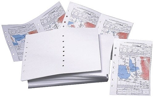
Perforated, 7-hole punched (center and edge) for Jeppesen binder.500 letter size sheets print up to 1.000 Jeppesen size sheets.

For VFR pilots who want a paperless and clear cockpit, JeppView Charts are the optimal solution.Digital flight navigation manual for visual flight (VFR) in Europe.The new generation of the proven Bottlang Manuals.Includes approach charts, aerodrome charts and aerodrome information.Simple and intuitive operation for a more efficient cockpit workflowNo annoying sorting of monthly paper revisions.The charts required for the flight can be compiled and printed out on the computer beforehand.The software included in the scope of delivery consists of 4 licences and is intended for use of the JeppView on conventional Windows PCs and laptops.In addition, the purchased map material can also be used in ForeFlight or the Garmin Pilot App.The price includes the correction service for 1 year. The data is obtained via download.You will receive the serial number and the corresponding download link by email after purchase.Coverage: Austria, Belgium, Bosnia-Herzegovina, Canary Islands, Croatia, Czechia, Denmark, Estonia, Finland, France, Germany, Greece, Hungary, Ireland, Italy, Kosovo, Latvia, Lithuania, Luxembourg, Malta, Macedonia (FYR), Montenegro, Netherlands, Norway, Poland, Portugal, Serbia, Slovakia, Slovenia, Spain, Sweden, Switzerland, United Kingdom.System requirements:Microsoft Windows 7 or higher1 GHz processor512 MB RAM3 GB free hard disk spaceInternet connection

For VFR pilots who want a paperless and clear cockpit, JeppView Charts are the optimal solution.Digital flight navigation manual for visual flight (VFR) in Europe.The new generation of the proven Bottlang Manuals.Includes approach charts, aerodrome charts and aerodrome information.Simple and intuitive operation for a more efficient cockpit workflowNo annoying sorting of monthly paper revisions.The charts required for the flight can be compiled and printed out on the computer beforehand.The software included in the scope of delivery consists of 4 licences and is intended for use of the JeppView on conventional Windows PCs and laptops.In addition, the purchased map material can also be used in ForeFlight or the Garmin Pilot App.The price includes the correction service for 1 year. The data is obtained via download.You will receive the serial number and the corresponding download link by email after purchase.Coverage: Austria, Belgium, Channel Islands, Czechia, France, Germany, Luxembourg, Netherlands, Poland, Slovakia, Switzerland.System requirements:Microsoft Windows 7 or higher1 GHz processor512 MB RAM3 GB free hard disk spaceInternet connection

If you already have the software Flymap, specify when ordering the serial number of your software!
