

Miscellaneous Charts and Manuals
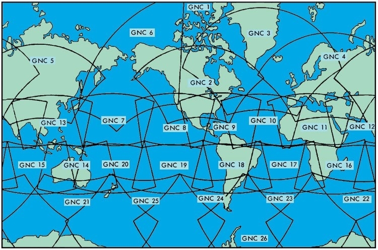
Scale 1:5.000.000. American Charts GNCPlease specify in comments box in the cart to the desired order of sheets!SALE!Remaining stock, the availability of all the leaves can not be guaranteed.

Scale 1:2.000.000. American Charts JNCSALE!Please specify in comments box in the cart to the desired order of sheets!Remaining stock, the availability of all the leaves can not be guaranteed.

Scale 1:1.000.000. American Chart series in Lambert conic projection. Worldwide coverage, some areas may not always be available. Sheet size 146 x 107 cm.Topographical Information:Cities, towns, highways, important landmarks, forests, rivers and lakes, elevations and hill shading.Aeronautical information:Aerodromes, military airspace and prohibited/restricted airspace, obstructions, enroute navaids, FIR-boundaries.ONC charts do not show frequencies. Civil controlled airspace is not depicted.When ordering, please specify the desired sheets in the field "notes regarding the order"!SALE!Remaining stock, the availability of all the leaves can not be guaranteed.

Komplettes Kit für VFR-Flüge in FrankreichInhalt:zwei mehrfarbige Karten Frankreich (Nord und Süd) mit komplettem Flugsicherungsaufdruck und topographischen Angaben, Maßstab 1 : 1.000.000eine Karte Frankreich militärische TiefflugstreckenBegleitheft mit Informationen zu Funknavigation, Luftverkehrsregeln, Beschränkungen (französisch/englisch)Lieferung in Kunststoffmappe mit Plotter.

Scale 1:500.000. The American TPC Charts series in Lambert conic projection is nearly worldwide available.Topographical Information:Borders, cities, rivers and lakes, highways, height information and hill shading.Flight Safety Information:Aerodromes, NAVAIDS without frequencies, prohibited and restricted areas.The sections correspond to the ONC series, but every sheet sized 146 x 107 cm contains only a quarter of the corresponding ONC coverage. The sheets are named according to the ONC chart system with a division into four segments as shown in the diagram (see picture 2, example for TPC chart sheet F-2B).When ordering, please specify the desired sheets in the field "notes regarding the order"!SALE!Remaining stock, the availability of all the leaves can not be guaranteed.


Guide for flights to Great Britain with airfield-infos and approach- and landingcharts. Infos and charts with over 450 airfields, spiral bond.


Unfortunately, the current edition is currently out of print. A new edition is expected to be published in winter 2025.german text

224 pages full-color Pilot's Atlas. Includes Europe, Middle East, South East Asia up to Japan and South Africa. Over 4.500 airports, shown by ICAO-code and IATA-code. 158 pages of maps, scale 1:2.000.000 for Europe, 1:4.000.000 for Asia and 1:2.750.000 for South-Africa, 27 pages overview-maps, and 39 pages Captains Corner.Scale 1:2.000.000 and 1:4.000.000 topographical charts are used showing over 4.500 airports. Waypoints, VOR/DME, NDB's and special use airspace are included, plus weather frequencies, points of interest, landmarks, airport directory with ICAO/IATA codes, major highways and city maps, just to name a few. Airports are colour coded by runway length and surface. International, regional and aerodromes are coded by symbol shape. Pilots now have the ability to point out objects on the ground or know immediately where they are in relation to surrounding airports or points of interest: an all-in-one source of information for pre-flight or during flightFive overview maps containing the following areas:one double page North Atlantic routesone double page African continentone double page Pacific routesone double page Australia routestwo double pages Asia routes to Japan andfour pages Satellite picture Europa + Asiafour pages Europe + Asia political mapfour pages Volmet + Distance map for Europe + Asiafour pages weather/mainwinds/average precipitation mapone page star chart/north poleone page Polar charttwo pages timezone 39 pages of Captain's Corner:Airport Directory with coordinates (Lat/Long) for every airportVolmet-BroadcastsSignificant Weather SymbolsMetarRVSM (Reduced Vertical Separation Minima)North Atlantic Track - Crossing ProcedureAfrica Regional ProceduresConversion Tables - Crosswind ComponentAerodrome Operating Minima (JAR-OPS 1)Holding Entry ProceduresHoldingClimb GradientsDe-icing Tables - Holdover TimesAbbreviationsSearch and RescueAerodrom SignsEmergency Communications Procedures Edition 2009, 224 pages, size 20 x 29 cm.

192 pages full-color Pilot's Atlas. Includes USA, Mexico and Canada. Over 5.500 airports, shown by ICAO-code. 104 pages maps, scale 1:2.000.000, 30 pages city-maps, scale 1:20.000 and 45 pages Captains Corner.Base cartography is from the US Road-Atlas 1: 2.000.000 which includes mountain ranges, lakes, rivers, cities, towns, railways, highwayw, parks, points of interest or of historic value.To this are added all airports in the USA (over 6.000), colour coded by runway length/surface and category, e.g. International, Regional, Civil/Military. VOR's/DME's, reporting points, waypoints, Volmet frequencies and Special Use Airspace are also shown.45 pages of Captain's Corner:World Aircraft RegistrationAirport Directory with coordinates (Lat/Long) for every airportSignificant Weather SymbolsMetarVolmet broadcastApproach MinimaHoldingDe-icing Table & FluidsConversion TablesIntercept ProceduresAirport SignalsAbbreviationsEmergency/SAR 192 pages, size 20 x 29 cm.

7th editionPublished by DFS Deutsche Flugsicherung, the Airfield Guide Europe Chart is edited in cooperation of the aeronautical information services of Germany, Poland and Spain. The frontside covers complete Europe, scale 1:4.000.000, the backside covers Central Europe, scale 1:2.000.000.2.800 civil and military airfields including codes (different symbols for IFR, VFR and military airfields)topographic information: rivers, mountains and international bordersairfield names now with IATA-CodesFIR description plus FIR Codesmore detailed terrain presentationSize 98 x 138 cm.
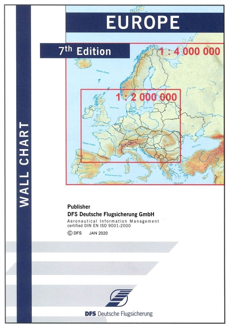
Published by DFS Deutsche Flugsicherung, the Airfield Guide Europe Chart is edited in cooperation of the aeronautical information services of Germany, Poland and Spain. The frontside covers complete Europe, scale 1:4.000.000, the backside covers Central Europe, scale 1:2.000.000.2.800 civil and military airfields including codes (different symbols for IFR, VFR and military airfields)topographic information: rivers, mountains and international bordersairfield names now with IATA-CodesFIR description plus FIR Codesmore detailed terrain presentationSize 98 x 138 cm.7th edition

Chart for flightplanning for North-Atlantic flights
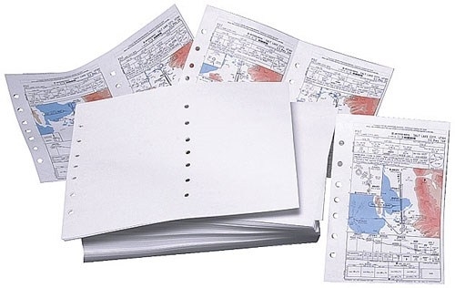
Perforated, 7-hole punched (center and edge) for Jeppesen binder.500 letter size sheets print up to 1.000 Jeppesen size sheets.
